
Gilbert ZIP Directory Coverage
Six standard postal zones cover the main Gilbert areas, with two edge cases that demand care. The labels below describe broad local character, not a house-by-house border. Postal boundaries can cross a town line, and neighborhoods can span postal areas. Use the Town of Gilbert area maps for the official ZIP map, then confirm a specific parcel in county or town GIS.
| ZIP Code | Areas Covered | Post Office | Notes |
|---|---|---|---|
| 85233 | West and northwest-central; Heritage area west side | Verify exact address with USPS | Boundary does not equal town line |
| 85234 | North and northeast; Val Vista Lakes and Morrison Ranch vicinity | Verify exact address with USPS | Neighborhood coverage is approximate |
| 85295 | Central and southeast; SanTan Village and Gateway area | Verify exact address with USPS | Mixed commercial and residential use |
| 85296 | Central and east; Agritopia and Finley Farms vicinity | Verify exact address with USPS | Gilbert civic campus uses this ZIP |
| 85297 | South-central; Power Ranch and Bridges vicinity | Verify exact address with USPS | Plats and permits are strong search keys |
| 85298 | Far south; Seville and Adora Trails vicinity | Verify exact address with USPS | Check postal and municipal edges in GIS |
| 85212 | Mesa postal geography touching the east edge | Verify exact address with USPS | Do not label the whole ZIP as Gilbert |
| 85299 | Reported nonstandard Gilbert code | Official result not captured | Treat as unverified until exact lookup |
The research did not locate an authoritative recent ZIP split, realignment year, or per-ZIP population table. It also could not capture an official USPS result for 85299. Those gaps matter. Do not infer a PO-box-only function from an unofficial list. For 85212, the Mesa postal label and Gilbert's east edge can overlap in common descriptions, so the parcel jurisdiction decides which public office holds a town-created record.
Gilbert ZIPs Do Not Set Jurisdiction
A postal city is part of an address. It is not a vote on municipal jurisdiction. Gilbert is legally a town, and its modern line grew through annexation. The Town GIS includes annexation values for Gilbert and Maricopa County, plus address categories that expose overlap between county and local geography. That evidence explains why the same mailing name, emergency address, and town boundary may not point to the same custodian.
Check the official mapping source before requesting a Town record. Gilbert's public GIS catalog exposes address locators, parcels, annexations, neighborhoods, recorded plats, buildings, and planning cases. A postal match may lead to county property and deed records even when the mailing name says Gilbert. A town building or planning file, by contrast, depends on the parcel's actual municipal status and the relevant date.
The Gilbert GIS service catalog shows the underlying map layers used to sort those questions.
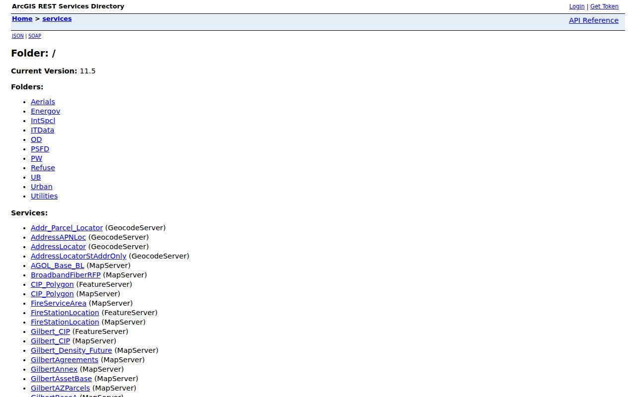
The service list is more than a technical index. It identifies the public layers that can verify an address, subdivision, annexation, or planning record after a postal code has narrowed the area.
Gilbert ZIP Areas by Character
The northwest and north hold more of Gilbert's older and smaller neighborhood fabric. The Heritage District and the west side of downtown fall broadly within 85233, while 85234 reaches north and northeast toward Val Vista Lakes and Morrison Ranch. Historical searches here should test old plats, museum files, regional directories, and earlier road names. Val Vista Road, for example, was known as Reebes before 1959.
Central and eastern 85295 and 85296 mix established neighborhoods, civic uses, and major commercial areas. Southern 85297 and 85298 include many newer master-planned communities. Plats, permits, recent deeds, and HOA boundary information often carry more weight there than an old city directory. The postal code helps select a source order, but it does not name a household.
Note: Neighborhood names describe useful search areas, but only an exact postal and parcel check settles a specific address.
Find Gilbert Residents by ZIP
The Maricopa County Assessor Parcel Viewer has a postal-area Search By mode. It can map up to the first 1,000 results, which makes it useful for exploring a broad area but not for building a complete resident roster. The result concerns parcels and title owners. A tax mailing address can differ from the situs address, which is the physical parcel location, and neither proves who occupies the home.
- Confirm the exact postal code through the USPS address lookup, not a neighborhood guess.
- Open the county Parcel Viewer and choose the postal option under Search By.
- Use results to identify parcels, then open one record for its APN, situs address, owner, and deed link.
- Check town annexation and address layers if the request depends on Gilbert jurisdiction.
- Move to a street or parcel search once the postal area is narrow enough.
Arizona voter records do not offer a public ZIP browser. The authenticated self-lookup requires identity data. County voter-file requests may be made by district or precinct, not ZIP, street, or radius, and A.R.S. § 16-168 strictly limits use and online posting. Once a ZIP leads to a named road, the Gilbert directory by street explains the address-level chain.
Note: The 1,000-result GIS cap can cut off a broad ZIP result, so treat the mapped set as an exploration view.
Gilbert ZIP Parcel Search Fields
The county property tools accept several keys after a postal area narrows the search. The parcel number, or APN, is the most stable short identifier. An MCR is a map reference that can connect a subdivision and recorded plat to a parcel. Owner and mailing data are useful clues, but only the situs field states where the land is located.
| Search key | Input type | Required | How it helps |
|---|---|---|---|
| ZIP Code | Search By mode | No | Maps up to the first 1,000 matching results |
| Parcel Number | Text | No | Accepts book-map-item style or undelimited APN |
| Owner Name | Text | No | Accepts surname and fuller given-name forms |
| Address | Autocomplete | No | Can work without city, state, ZIP, or street type |
| Subdivision or MCR | Text | No | Lists parcels tied to a recorded map or subdivision |
The Maricopa County Parcel Viewer supports parcel, owner, address, subdivision, MCR, and section-township-range paths. Search, open Results, and select a parcel to zoom. Clicking a new polygon replaces the feature information, which helps test a boundary one lot at a time.
Note: Save the APN before leaving a parcel result because it links the map, tax account, deed, and plat.
Gilbert's 85212 Edge Case
85212 is Mesa postal geography that touches Gilbert's east-edge area. It should never be described as wholly Gilbert. An exact address needs two checks: USPS for the mailing form and parcel GIS for the local jurisdiction. That pair avoids sending a town-record request to the wrong office or attaching a Gilbert label to land outside the town.
The same method handles far-south 85298, where the municipal and postal edge needs a close GIS check. When a parcel rests in unincorporated Maricopa County, county sources may control its land or development trail. When it lies inside Gilbert, town building, planning, and GIS records can supplement the county deed and tax sources.
Southern Gilbert ZIP Records
Power Ranch and the Bridges sit broadly in 85297, while Seville and Adora Trails are associated with 85298. These areas reflect Gilbert's newer growth. A search should lean on subdivision names, recorded plats, permit or planning files, parcel numbers, and recent deed links. The legal description can stay stable even when a mailing label or road detail changes.
Town GIS provides neighborhood and planning context, while the Assessor and Recorder hold the land chain. The Town public-record portal can handle building records, as-builts, GIS spatial data, and general Town records. If the online layer does not expose the needed date or file, make a narrow request naming the address, APN, subdivision, record type, and date range. Arizona Public Records Law calls for prompt access, but privacy review, complexity, and volume can affect timing.
Note: A subdivision name can be a better search key than a ZIP when a portal offers plat or business-name fields.
North Gilbert ZIP History
The Heritage District sits in the older record landscape. Seven named plats appear on the town's historic-neighborhood map: Gilbert Townsite, Creeds Addition, Ayers Subdivision, Hearne Addition, Cooper Addition, Lacy Tract, and Greenhaw Place. Those names are stronger historical keys than a current ZIP. Search the Recorder by subdivision or business name, then connect lot and block to the Assessor parcel.
Older land may appear under rural Maricopa County or a nearby East Valley label because the county record line predates Gilbert's 1920 incorporation. The 1970 strip annexation and later expansion make today's border a poor guide to old filings. A current postal directory can organize the first pass, but plats, legal descriptions, and annexation dates preserve continuity across time.
Gilbert ZIP Limits Explained
A postal directory answers a delivery question first. It does not set Gilbert's municipal line, school district, voting precinct, subdivision, or parcel boundary. Each system was built for a different task. That is why a person search should keep the address layers apart until the exact parcel and custodian are known.
- ZIP and ZIP+4
- A ZIP identifies a delivery area; the added four digits narrow delivery to a smaller segment.
- PO-box ZIP
- A code assigned mainly or solely to post-office boxes rather than street delivery.
- Unique ZIP
- A code assigned to one organization or site with enough mail volume to warrant it.
- Carrier route
- The sequence or area served by one postal carrier within a broader ZIP.
The research did not verify 85299 as a PO-box or unique code through an official USPS result. Keep it marked as a nonstandard reported code until an exact-address check confirms the postal use. That restraint is better than converting a directory claim into a false local fact.
Note: No authoritative recent Gilbert ZIP split or realignment date was found, so none should be inferred from map changes.
Gilbert ZIPs and Historic Records
A present ZIP can help organize family research, but it does not govern access to old vital records. Arizona law makes birth certificates public after 75 years and death certificates public after 50 years. Newer certified copies require eligibility and identification. Archive transfers can lag the date arithmetic, so researchers must check the genealogy portal's actual posted holdings.
The Arizona historical vital-record thresholds state the legal rule.
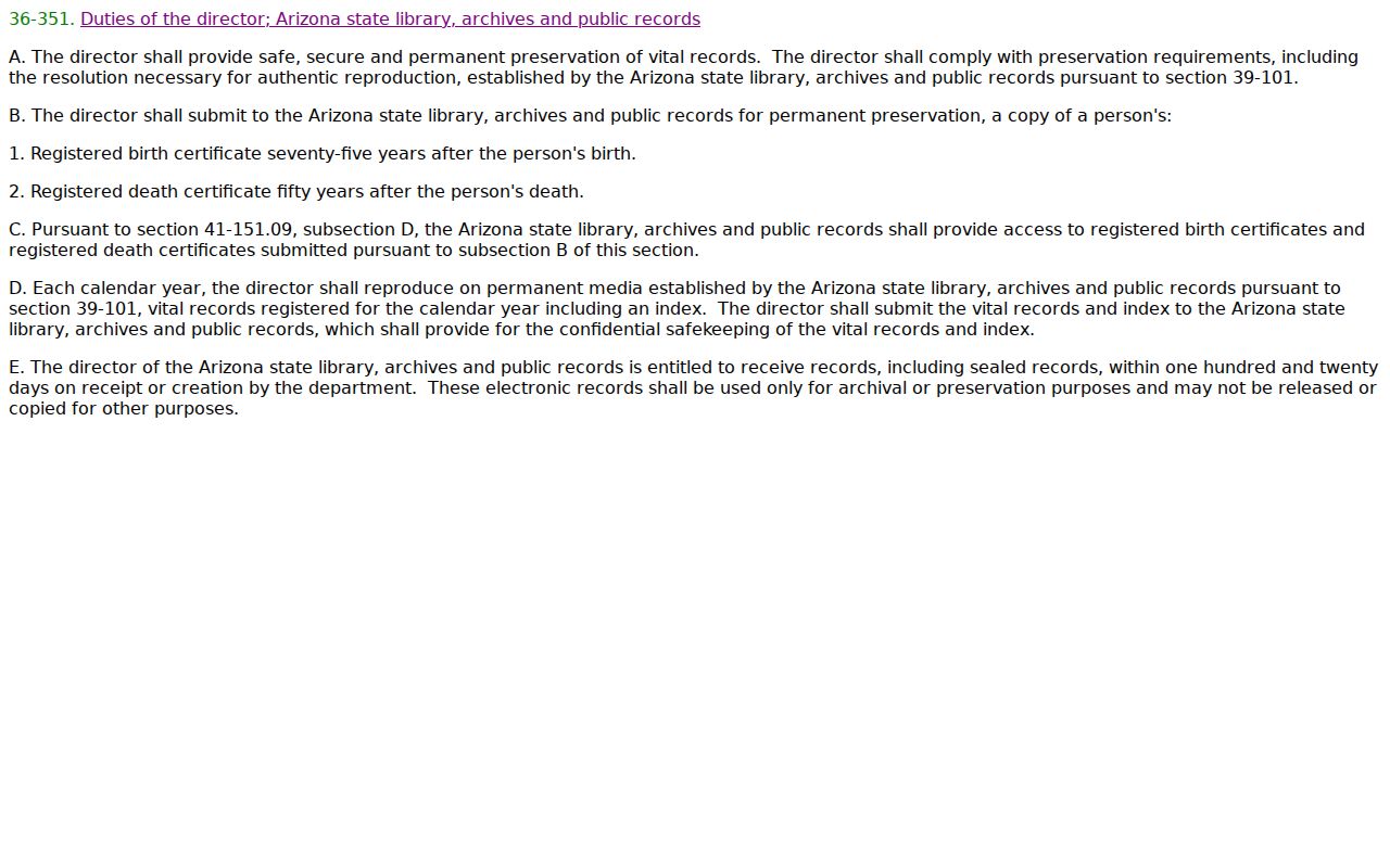
The statute helps separate a public historical search from an application for a recent certified copy. A ZIP may narrow a place, while the record date and statutory access rule decide what can be released.